為什麼這篇南化水庫門票鄉民發文收入到精華區:因為在南化水庫門票這個討論話題中,有許多相關的文章在討論,這篇最有參考價值!作者reesion (阿湯哥)看板Tainan標題[遊記][南化] 南化水庫、源之旅休閒公園、大地谷...
遊記名稱:南化水庫、源之旅休閒公園、大地谷
圖文版網誌:http://www.tainanlohas.com/blog/post/265406287
地址:台南市南化區玉山里139號旁(南化水庫)
台南市南化區南179線12.5公里處(大地谷)
電話:06-5772896(南化水庫)
營業時間:理論上是24Hr,但請入夜前前往
公休:無
門票:無
可否刷卡:否
座標(度分秒):23°05'12.2"N 120°32'13.7"E(南化水庫景觀台)
23°05'33.1"N 120°32'02.3"E(源之旅休閒公園)
23°07'42.8"N 120°33'48.1"E(大地谷)
http://pic.pimg.tw/tainanlohas/1424778628-1255436386.jpg
今年過年的時,趁著初四天氣還不錯,樂活團決定前往南化,
來一段探索秘境的走春之旅。我們的首站來到了位於台二十線省道(南橫公路),
往甲仙方向的南化水庫
http://pic.pimg.tw/tainanlohas/1424778628-3516703015.jpg

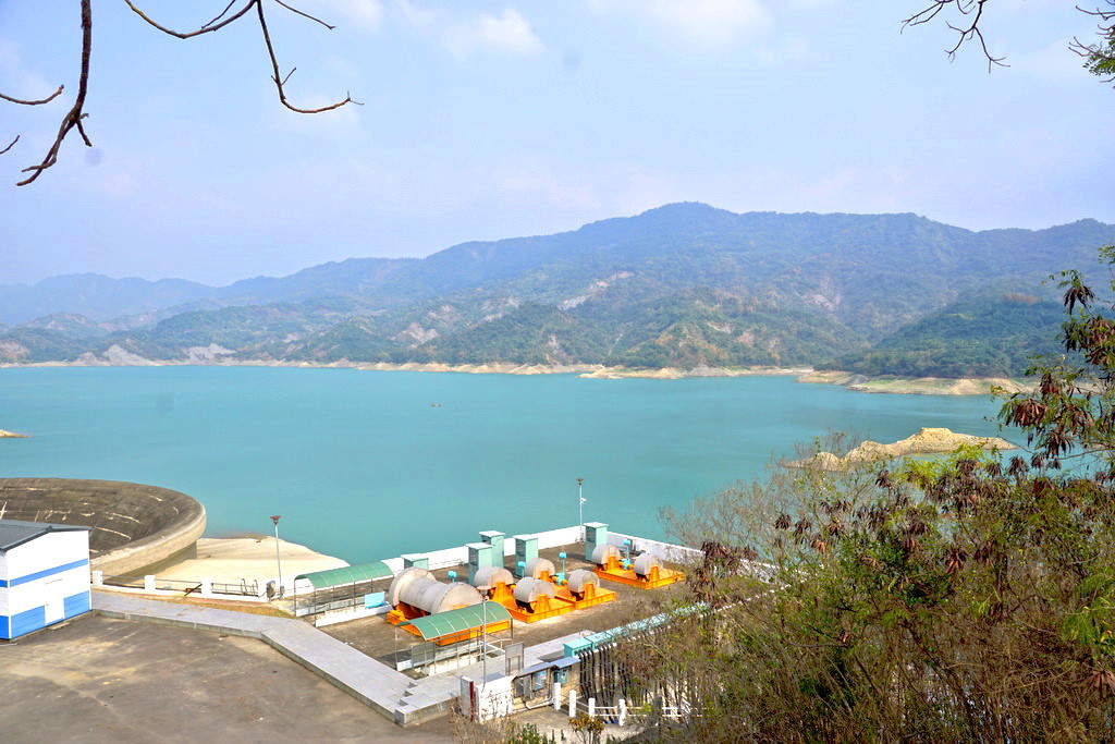
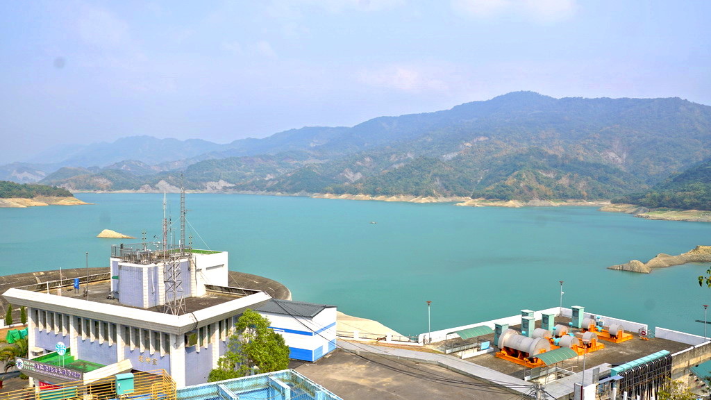
南化水庫建於1988年,並於1994年完工,主要供應大台南和大高雄地區的公
共給水兼具觀光旅遊。南化水庫係「行政院十四項重大經建計畫」之一,
為了增加南化水庫的進水量,南區水利局在甲仙六義山進行了鑿山取水的浩大工程,
將鹿鳴山穿孔取楠梓仙溪的河水,以注入南化水庫
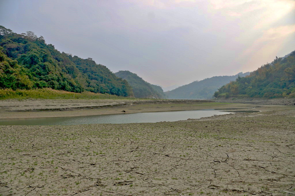
http://pic.pimg.tw/tainanlohas/1424778629-184894521_l.jpg
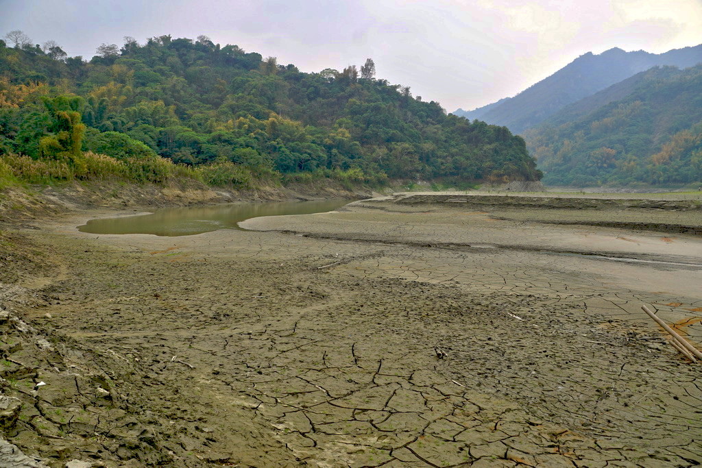
由於現在還是枯水期的關係,水庫的水量有些低,再加上還沒正式進入春天,
四周的景色並沒有非常亮眼。南化水庫可以參觀的地方只有景觀台一處,
停留的時間約為10分鐘左右
http://pic.pimg.tw/tainanlohas/1424778630-3960746007.jpg
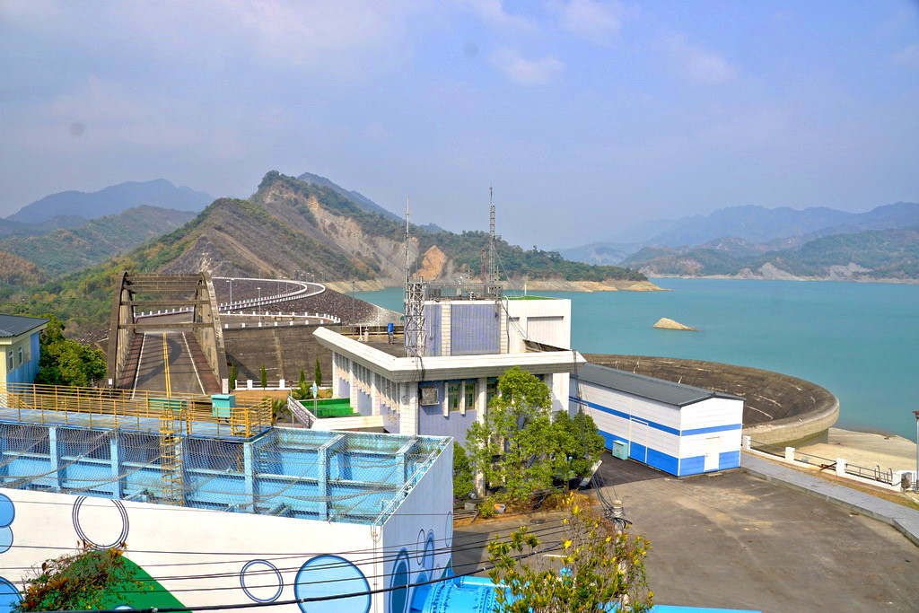
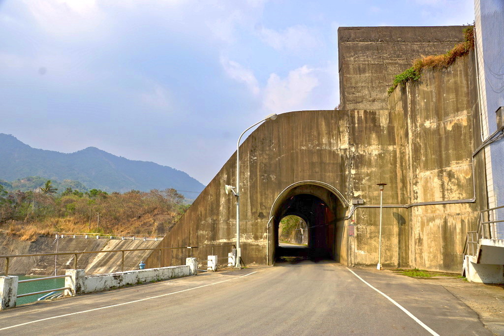
離開了南化水庫的景觀台,我們來到了位於水庫下方的小徑,途中要穿越大壩的底下
http://pic.pimg.tw/tainanlohas/1424778632-3429574088.jpg
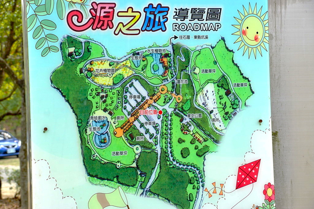
不一會功夫,我們來到了源之旅休閒公園。這裡原是噍吧哖古戰場,
南化區公所在此成立了軍史公園、環保公園、親水公園合稱為「源之旅休閒公園」
http://pic.pimg.tw/tainanlohas/1424778634-59478485.jpg
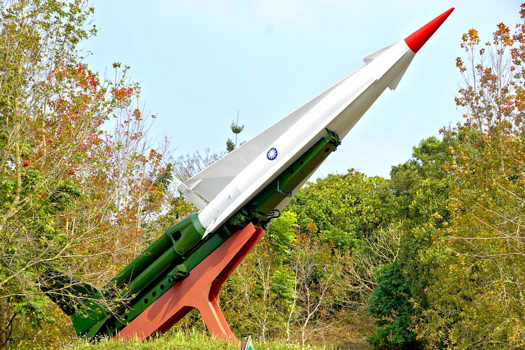
軍史公園中有很多退役的軍事機械,下圖是勝利女神飛彈
http://pic.pimg.tw/tainanlohas/1424778637-881437077.jpg
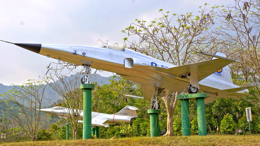
F-5E戰鬥機,1974年服役的戰機
http://pic.pimg.tw/tainanlohas/1424778638-688668135.jpg
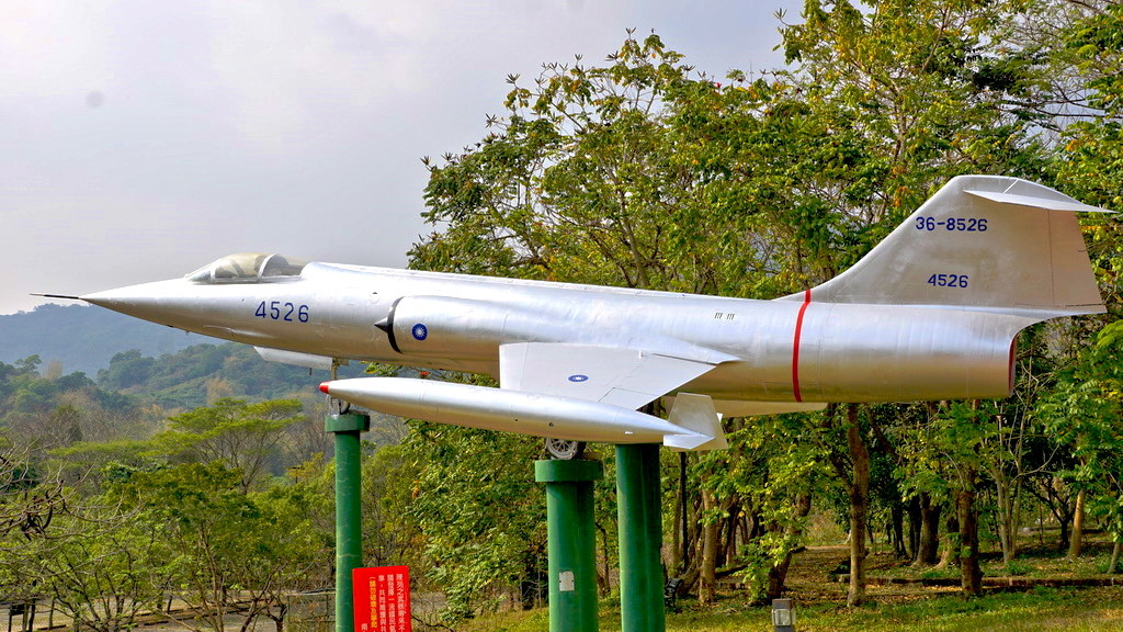
F-104,為1960年服役的戰機,到1998年退役
http://pic.pimg.tw/tainanlohas/1424778639-2290809994.jpg
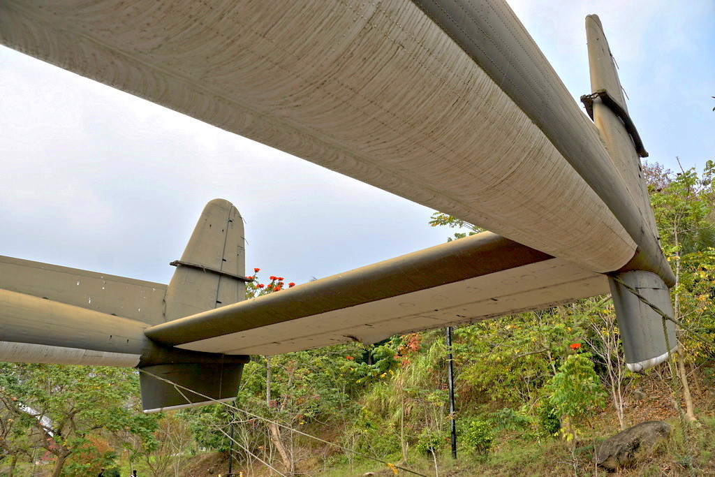
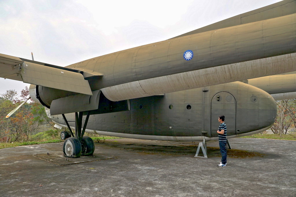
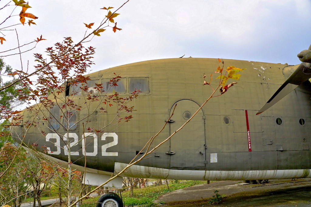
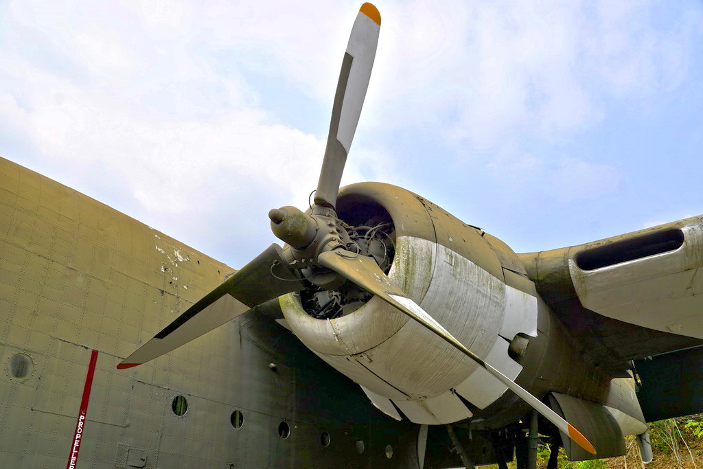
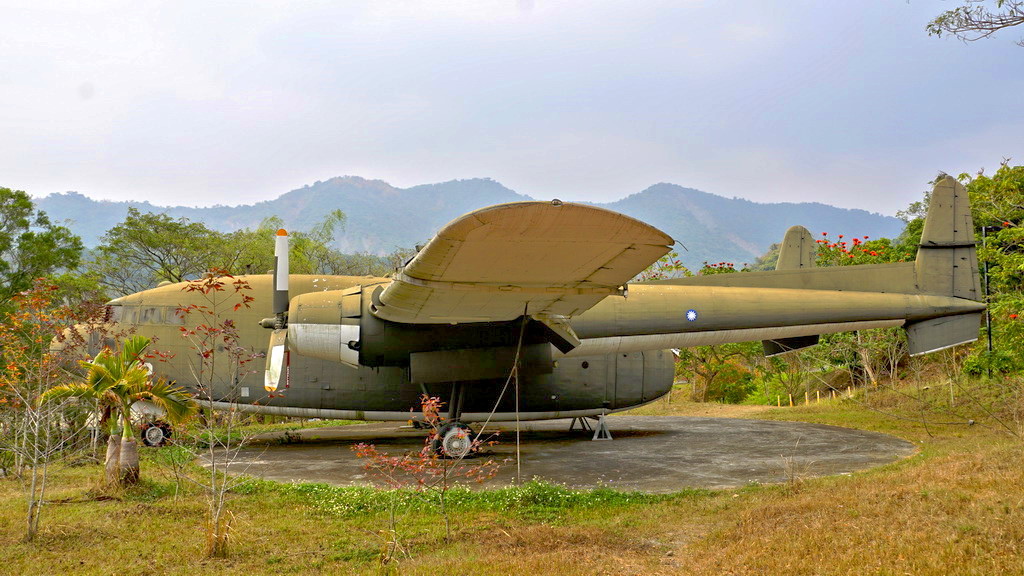
C-119,1958年開始服役的軍用運輸機,俗稱老母雞,1997年退役
http://pic.pimg.tw/tainanlohas/1424778640-709563361.jpg
由於整個源之旅公園還算大,為了不妨礙接下來的大地谷行程,
我們決定先逛到這裡,然後往順著台二十線並左轉進入關山。
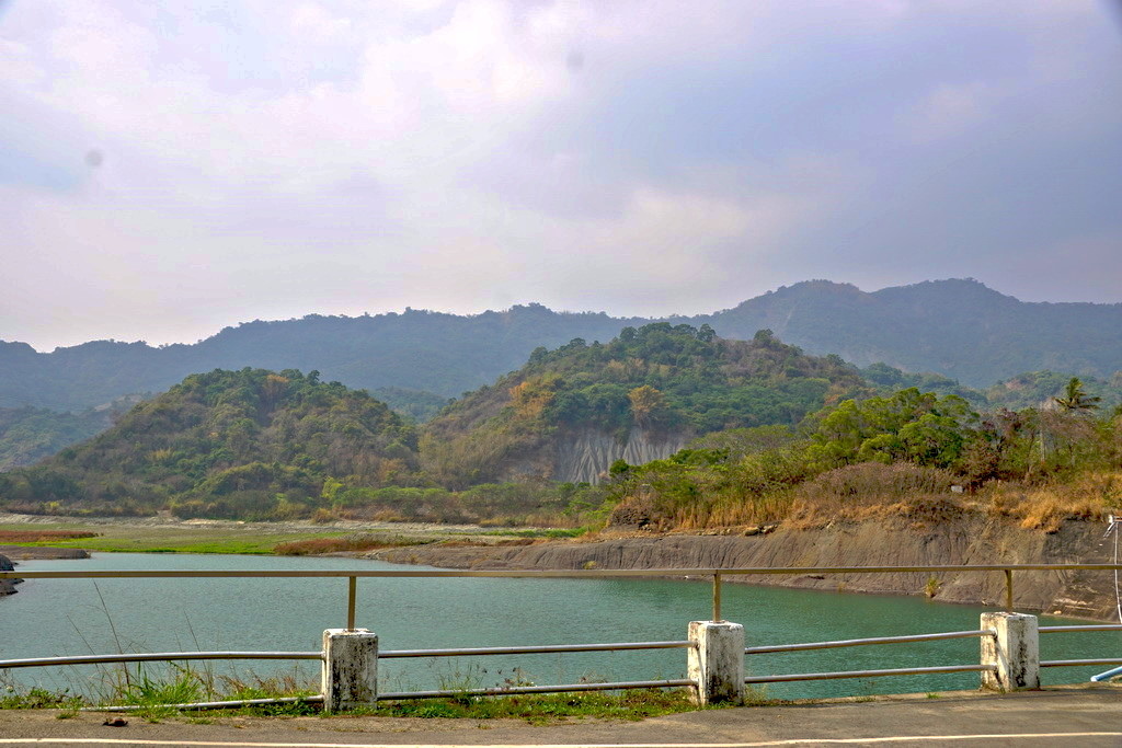
關山里位於南化水庫的上游,有著不少瀑布、溪谷等景觀。
今天我們要探訪的秘境,就是在南179線12.5公里處的大地谷。
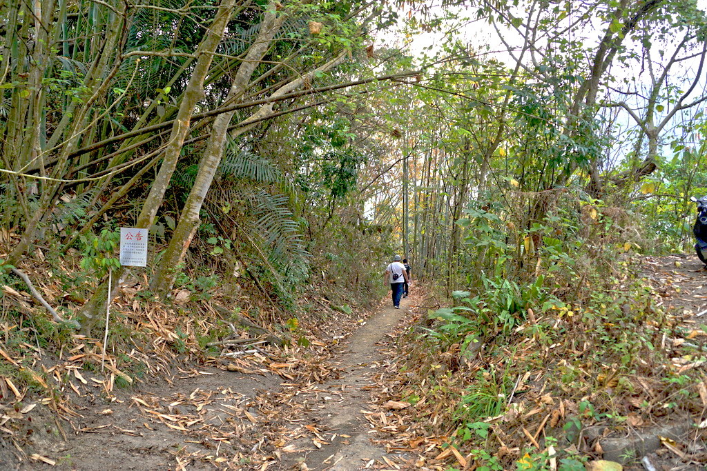
入口處如同一般的山區小徑,沒有任何的標示與說明
http://pic.pimg.tw/tainanlohas/1424778645-1143087970.jpg

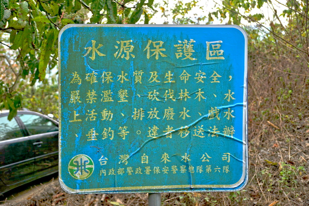
因為地處水庫的上游,所以這裡也是水源保護區,禁止濫墾濫伐、
水上活動、排放廢水、戲水與垂釣等等。另外要提醒,請勿亂丟垃圾、
煙蒂等廢棄物,進入時儘量穿著不透水的鞋子為佳
http://pic.pimg.tw/tainanlohas/1424778646-915244023.jpg
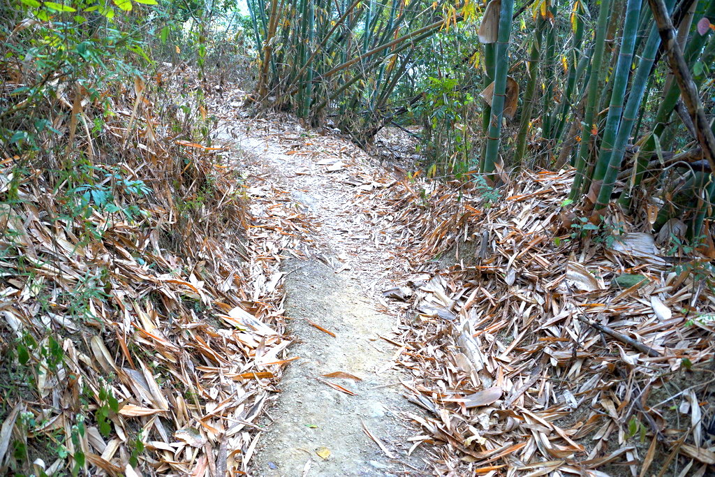
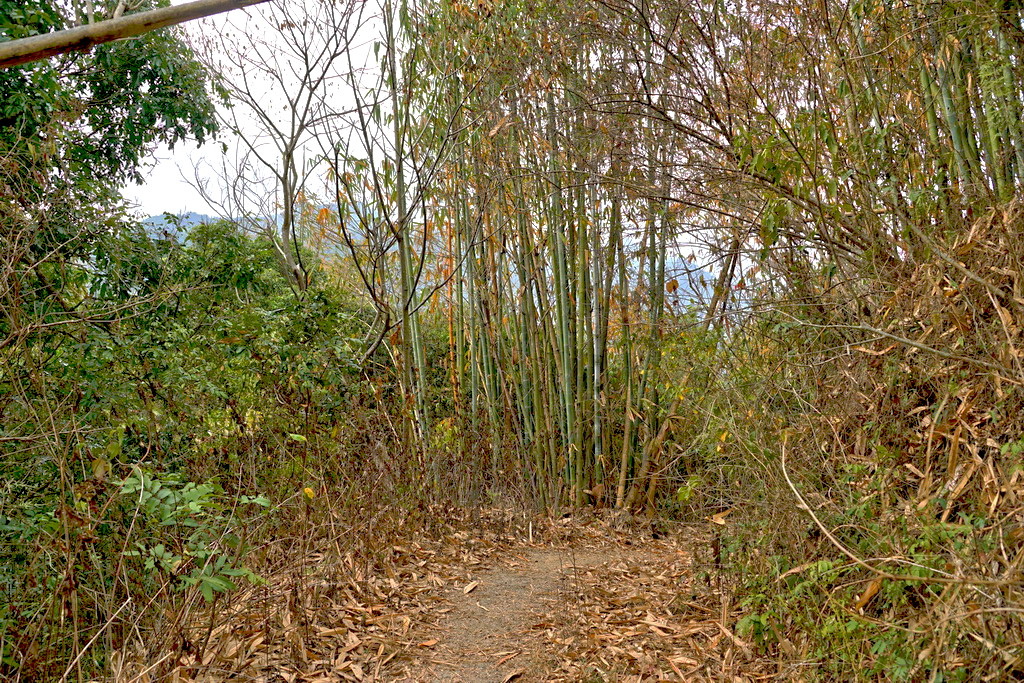
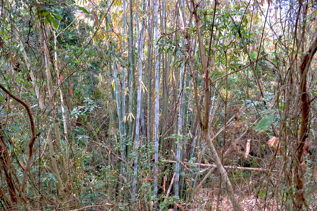
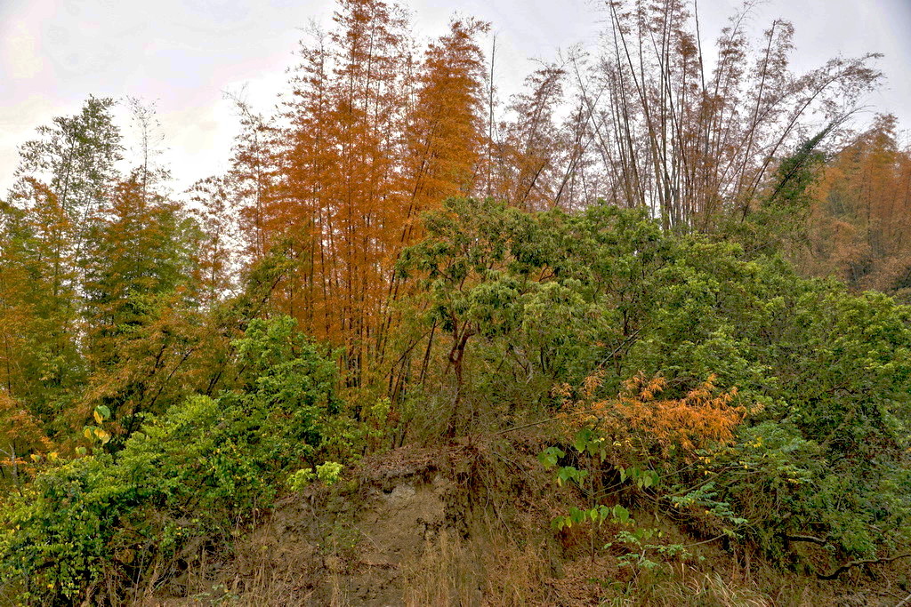
往大地谷的第一段路圖是以竹子為主的下坡小徑,有幾處坡度很陡的地方,
行經時要特別注意一下以免滑倒,沿途除了竹子之外還有很多低海拔山區的植披
http://pic.pimg.tw/tainanlohas/1424778647-2951173839.jpg


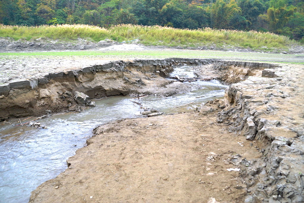
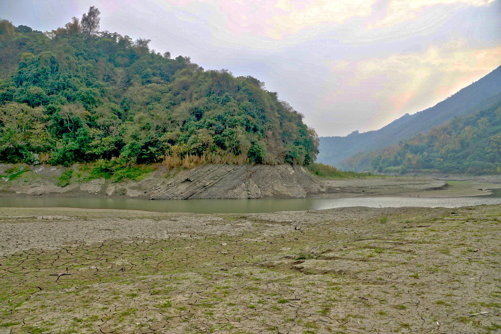
第二段是後掘溪畔,也是前往大地谷必須穿越的地方,
所以只有每年的12月底一直到隔年清明前後的枯水期才能造訪這邊
http://pic.pimg.tw/tainanlohas/1424778657-2680836180.jpg
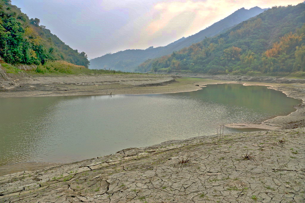
河畔有一處水量最少的地方,有竹子搭乘的便橋可以通過,
但還是要小心腳步以免滑倒
http://pic.pimg.tw/tainanlohas/1424778658-4027476494.jpg
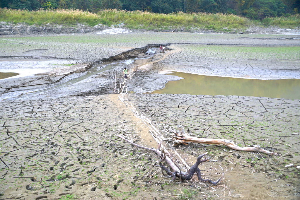

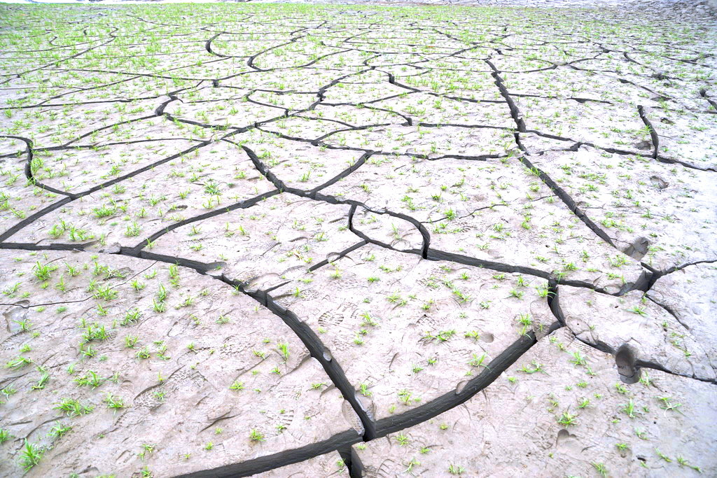
因為是枯水期的關係,河床有一大片裸露龜裂的地方,看起來格外的有意境
http://pic.pimg.tw/tainanlohas/1424778663-1726703877.jpg
到了後掘溪對岸,還要穿越一片青草叢生沙地
http://pic.pimg.tw/tainanlohas/1424778665-3826642921.jpg
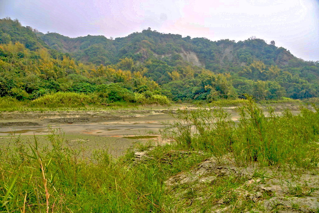
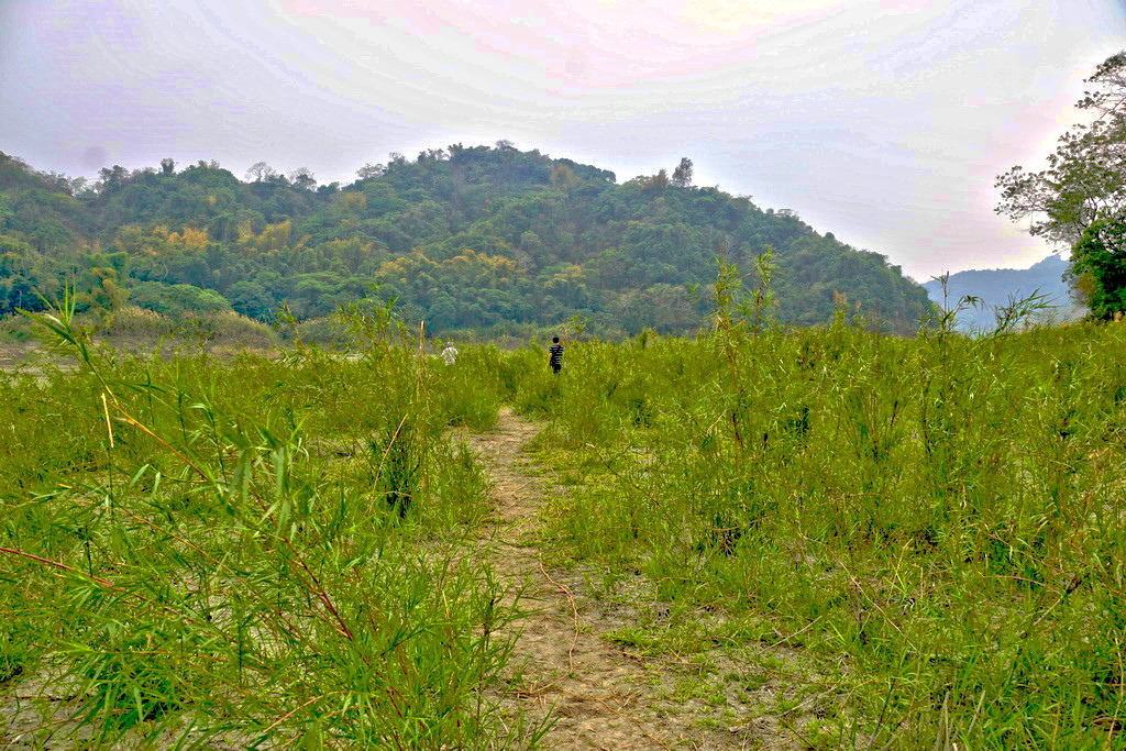
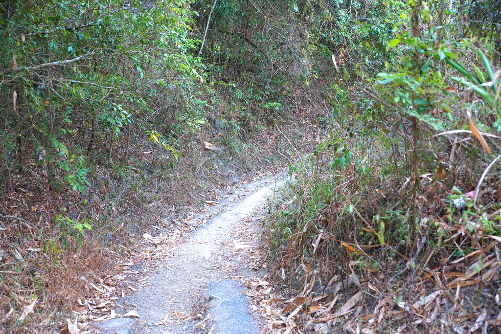
之後的路是比較平穩的乾枯地形,河道也逐漸變大,
廣闊的谷底平原讓人顯得心曠神怡
http://pic.pimg.tw/tainanlohas/1424778670-1362368398.jpg
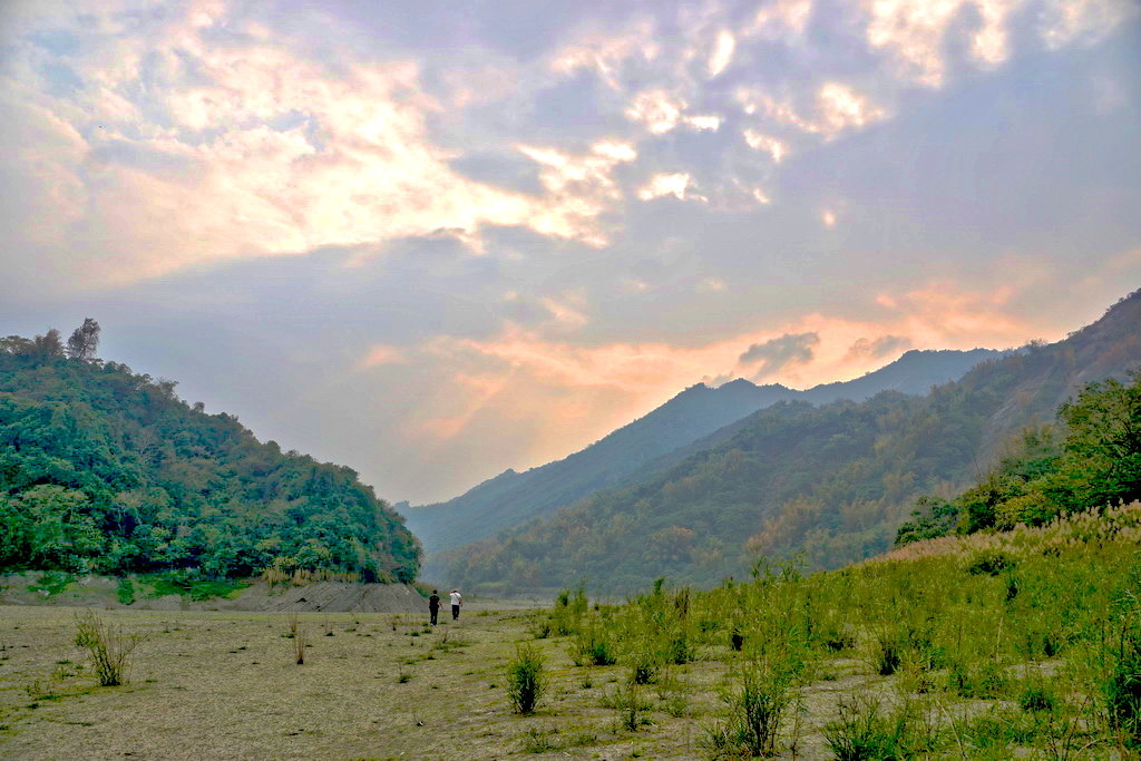
節氣上才剛入春,很多植物進入了青黃不接的階段,搭配夕陽的輝映更顯得如詩如畫。
但因為時間有點晚的關係,我們不能停留太久
http://pic.pimg.tw/tainanlohas/1424778674-1089418642.jpg

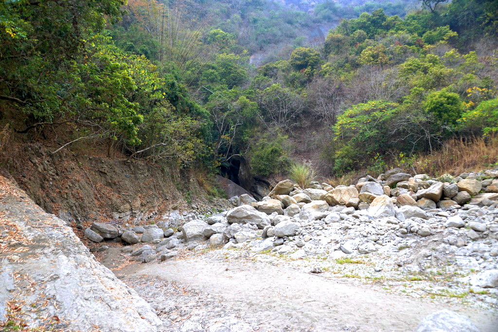
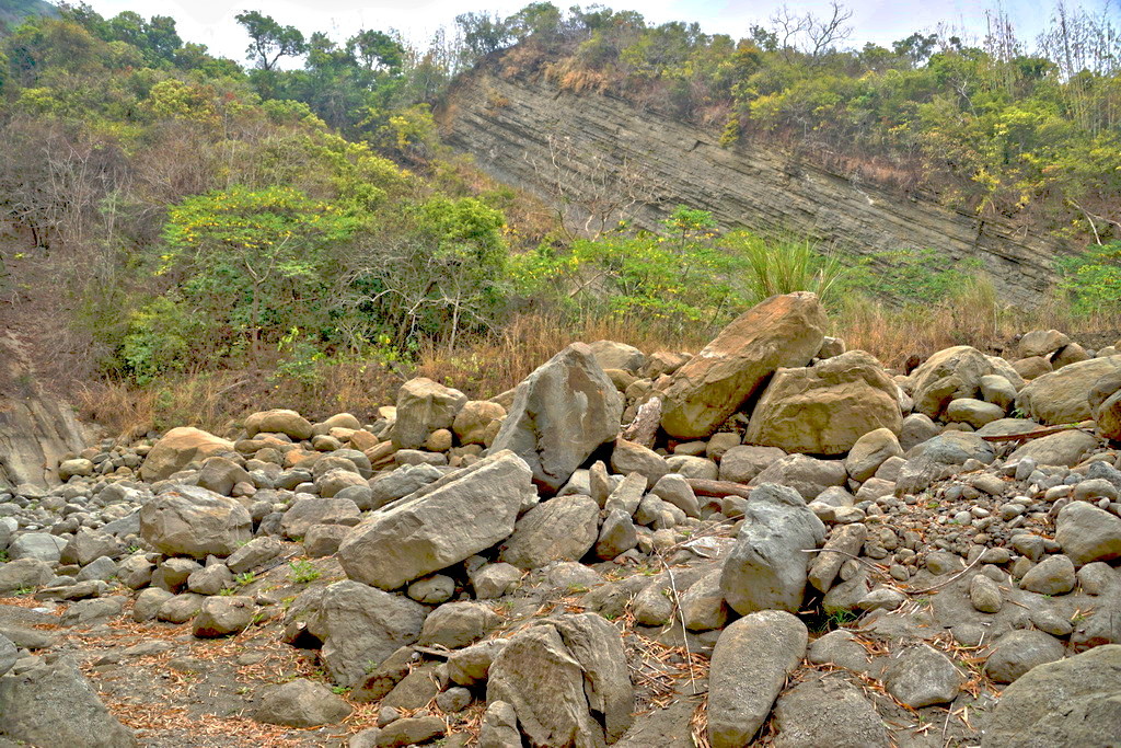
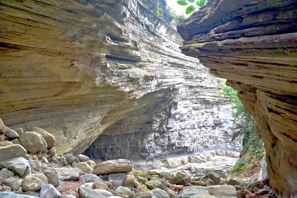
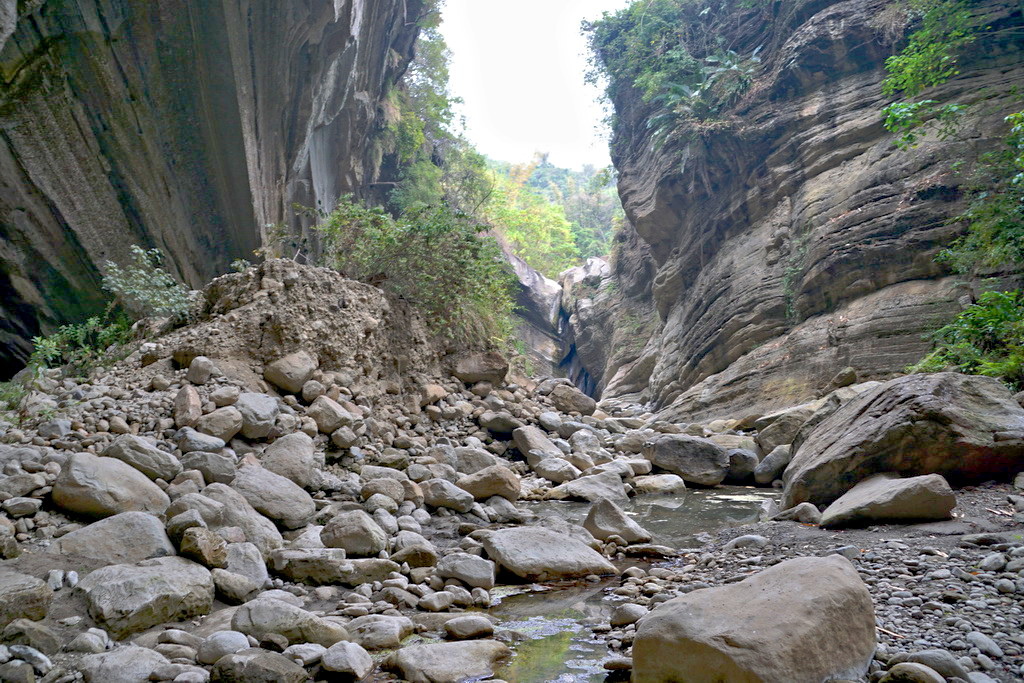
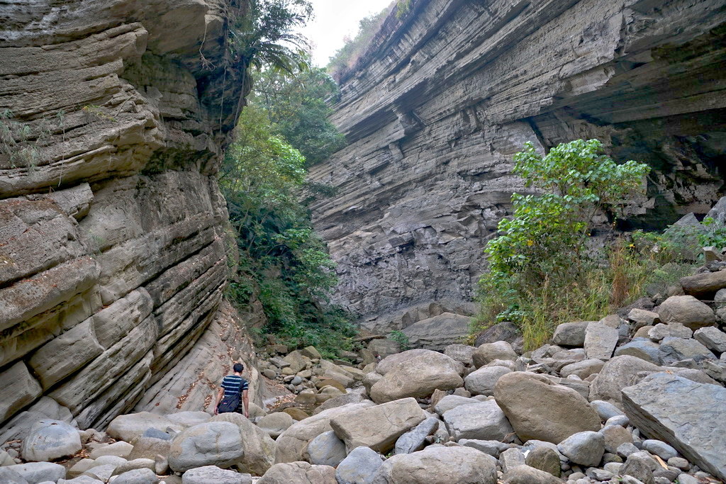
今天旅程的最後一段就是進入大地谷,入口的落石最小的只有幾公分,
最大的有幾公尺以上,讓人不禁感嘆大自然的偉大
http://pic.pimg.tw/tainanlohas/1424778677-1536372270.jpg
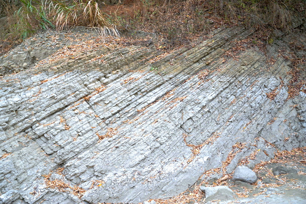

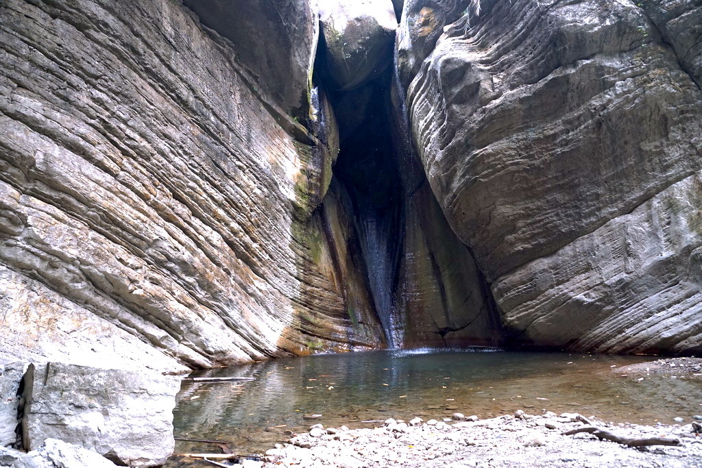
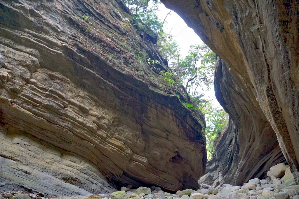
大地谷的入口處,看得出是經年累月才沖蝕出來的河谷,還留著小溪流的痕跡
http://pic.pimg.tw/tainanlohas/1424778686-2337272932.jpg
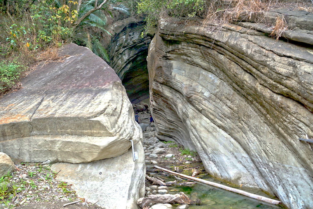
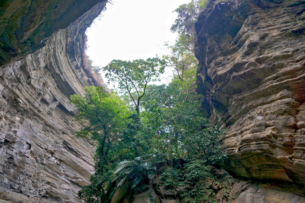
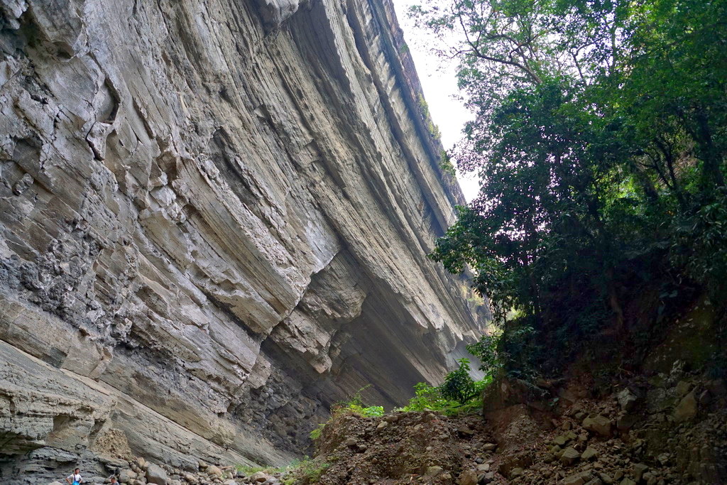
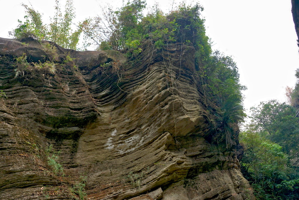
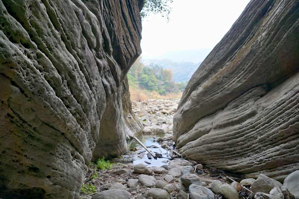
地谷中溫度比外面低幾度,兩旁盡是岩層的斷面,還有一些植披在上方
http://pic.pimg.tw/tainanlohas/1424778690-969325778.jpg

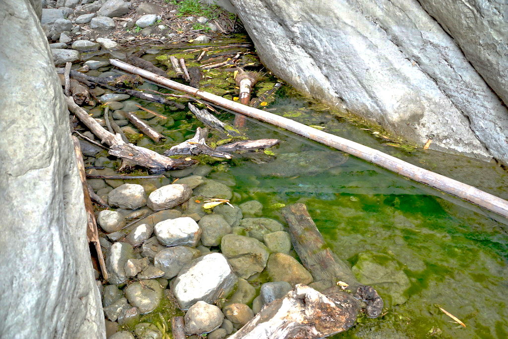
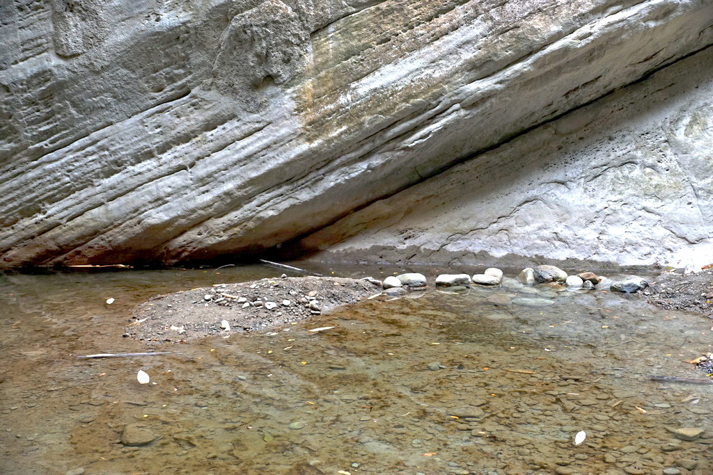
地谷的盡頭是小瀑布與淺水潭,不知怎麼搞的,
總覺得瀑布旁的大石有點像一張人臉!
http://pic.pimg.tw/tainanlohas/1424778700-789942199.jpg


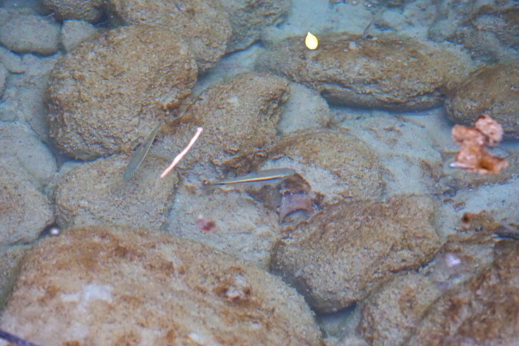
本來為水潭中沒有生物,但仔細一看就可以發現小魚群還不少,
在岩石堆中還躲著溪蝦呢
http://pic.pimg.tw/tainanlohas/1424778704-829080566.jpg

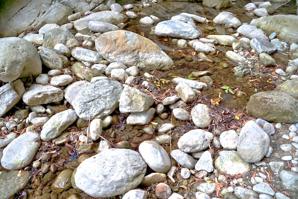
回程也是順著原路,由於地形相當崎嶇,還是要提醒一下行進時要注意腳步
http://pic.pimg.tw/tainanlohas/1424778708-3442157325.jpg
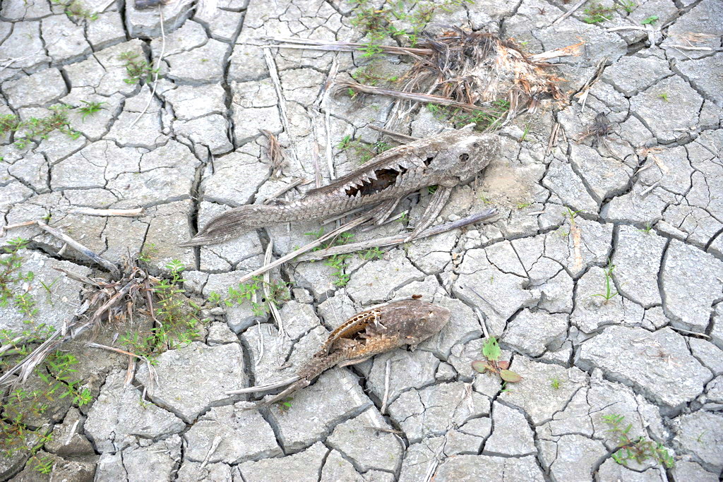
回程中意外的發現,乾枯的魚骨,看樣子應該是底棲型魚類
http://pic.pimg.tw/tainanlohas/1424778712-1030414163.jpg
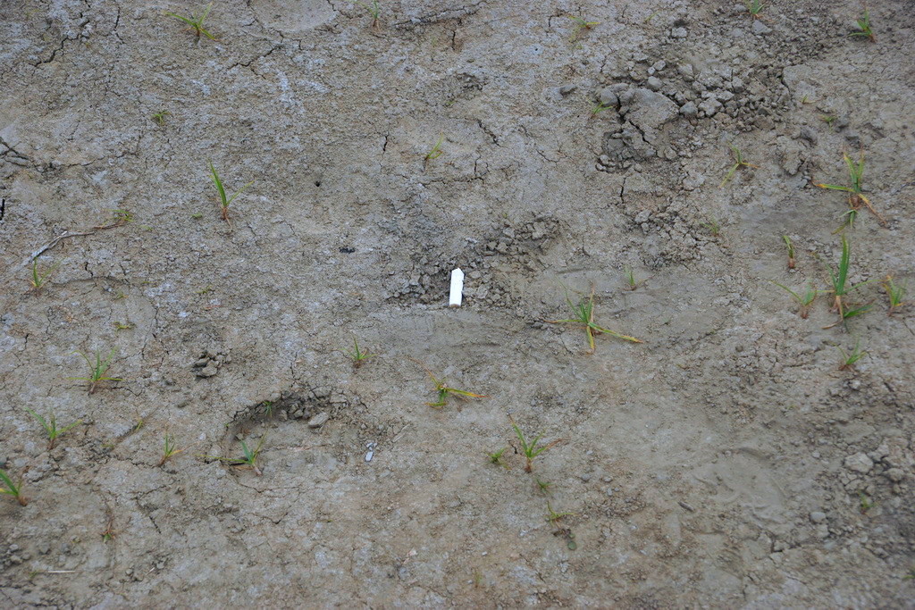
另一個發現就是最討厭的煙蒂,而且為數還不少。
再次提醒來這裡的大家,一定發揮公德心,共同保護這個美景喔!
http://pic.pimg.tw/tainanlohas/1424778712-2005909708.jpg
--
樂活台南美食團 成員募集中!
https://www.facebook.com/groups/651465728241827/
徵求熱愛台南、美食、旅遊、攝影的團員
活動範圍:早餐、中餐、晚餐、宵夜、點心、出遊
活動內容:吃吃喝喝、拍拍照、打卡、分享心得之類的
非固定、不定期出團,身份不限,也十分歡迎部落客,
可以站內信給我問問題喔
--
樂活台南
http://www.facebook.com/tainanlohas
全食記、遊記搜尋:按a鍵 -→ 搜尋作者: reesion
本ID不接受任何試吃或付費邀約,請業代、公關公司自重,勿再寄信詢問
--
※ 發信站: 批踢踢實業坊(ptt.cc), 來自: 112.104.21.165
※ 文章網址: https://www.ptt.cc/bbs/Tainan/M.1424786112.A.CAB.html
→ self112012: 新聞有報:大地谷屬林務局嘉義林業管理處管轄, 02/24 22:35
→ self112012: 基於安全考量, 2014 三月七日拉起封鎖線不讓遊客進入 02/24 22:37
→ a053473348: 但還是有人會進去 02/24 22:55
※ 編輯: reesion (112.104.21.165), 02/25/2015 21:59:51推 etu4315: 去過+1,真的很壯觀! 02/26 10:09